


UAV Dragonfish Light (T3H)
Clever. Simple. Effective.
Dragonfish’s unique rotor design simplifies operation while maximizing productivity and efficiency. With no complicated moving parts, Dragonfish is modular, waterproof, smart and reliable. Dragonfish is mission ready out of the box and includes powerful AI tracking capabilities and a variety of modular payload options. Endurance of up to 180 minutes (including payload) further increases Dragonfish’s powerful mission capabilities and puts it well ahead of the competition.
- 81 minutes is the longest flight time with cargo
- 5 minutes to assemble
- 4K 50x optical zoom
- 108 km/h maximum speed
- 30 km data transmission range
- 5s system loading and self-check
108700,00 €
Available on backorder
INTELLIGENT. SIMPLE. EFFECTIVE
The unique design of the Dragonfish quadcopter with rotary motors simplifies operation while maximizing performance and efficiency. With no complex moving parts, Dragonfish is modular, waterproof, intelligent and reliable. Dragonfish is mission ready out of the box and features powerful AI tracking capabilities and a variety of modular payloads.
Dragonfish series includes three models: Dragonfish Lite, Dragonfish Standard and Dragonfish Pro. With a flight time of 81 minutes, 126 minutes and 158 minutes with payload, respectively.
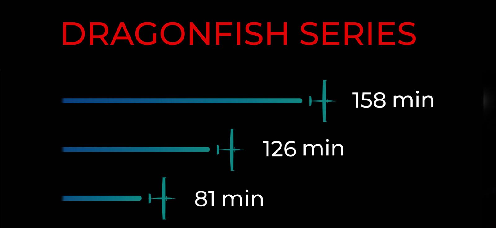
81min
Flight duration
4k 50x
Stabilized optical zoom
5 min
Harvest time
108 km/h
Maximum speed
30 km
Maximum speed of video transmission
5-sec
Boot time and system self-test
Intelligence and Autonomy
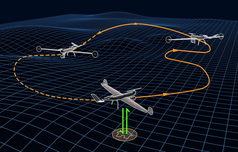

Intelligent tracking using AI

Object coordinates

Adaptive Tracking
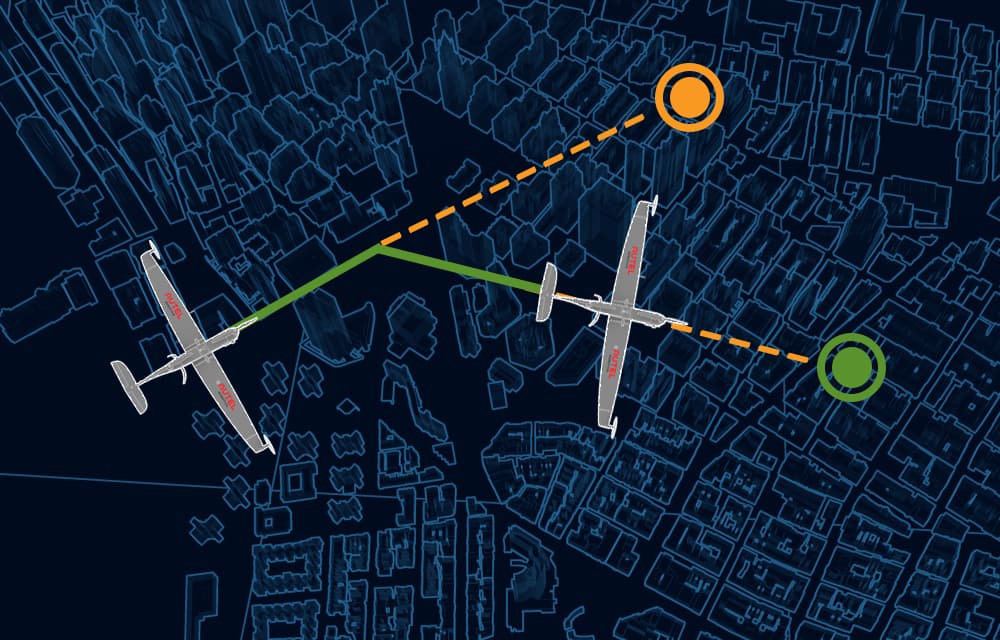
Quick mission
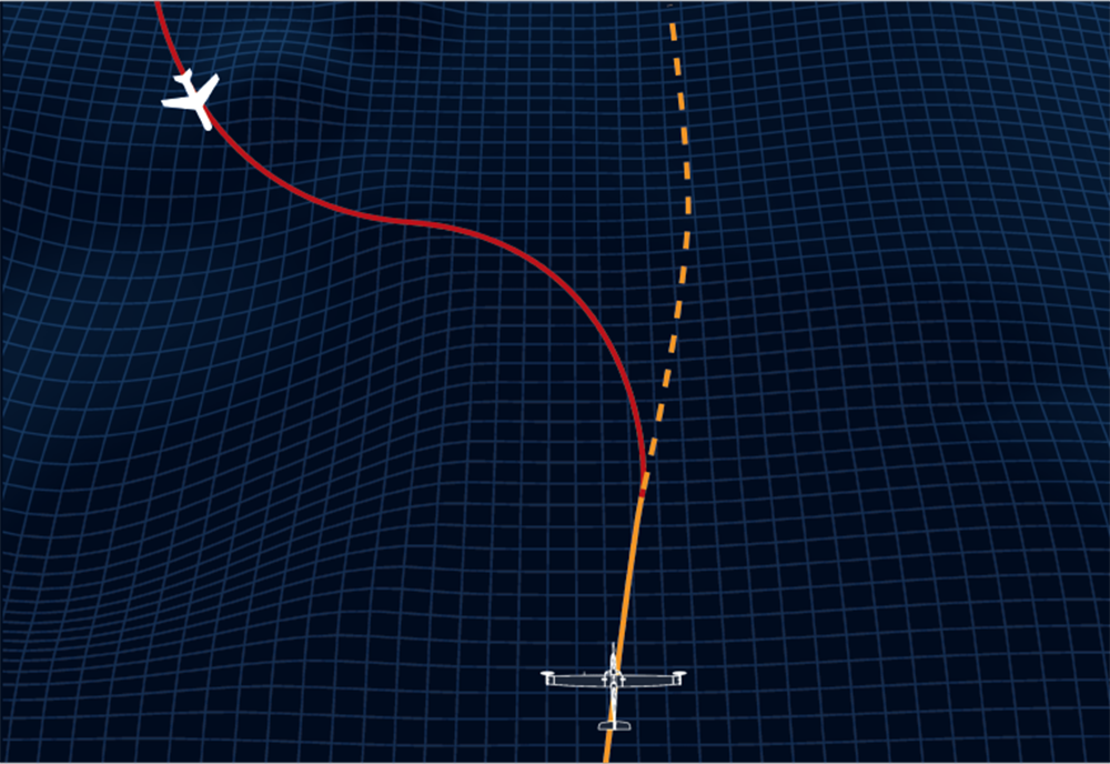
ADS-B receiver
In particular, Dragonfish can notify operators of the location, altitude and speed of manned aircraft approaching the UAV. A built-in ADS-B receiver providing this information makes flying much safer.

RTK accuracy
Dragonfish is equipped with two RTK modules with mutual redundancy. The integration of the GNSS base station with the RTK modules gives the Dragonfish quadcopter centimeter positioning accuracy, flawless movement clarity and reliable protection against electromagnetic interference. The mutual redundancy of modules significantly improves the quality of image metadata required for photogrammetry, and also makes flight routes more accurate and safer. The Autel Robotics GNSS base station provides centimeter accuracy and supports all four major satellite navigation systems. </lt -div></p ></lt- span></ lt-div></lt -span></lt- span>
RTK Accuracy
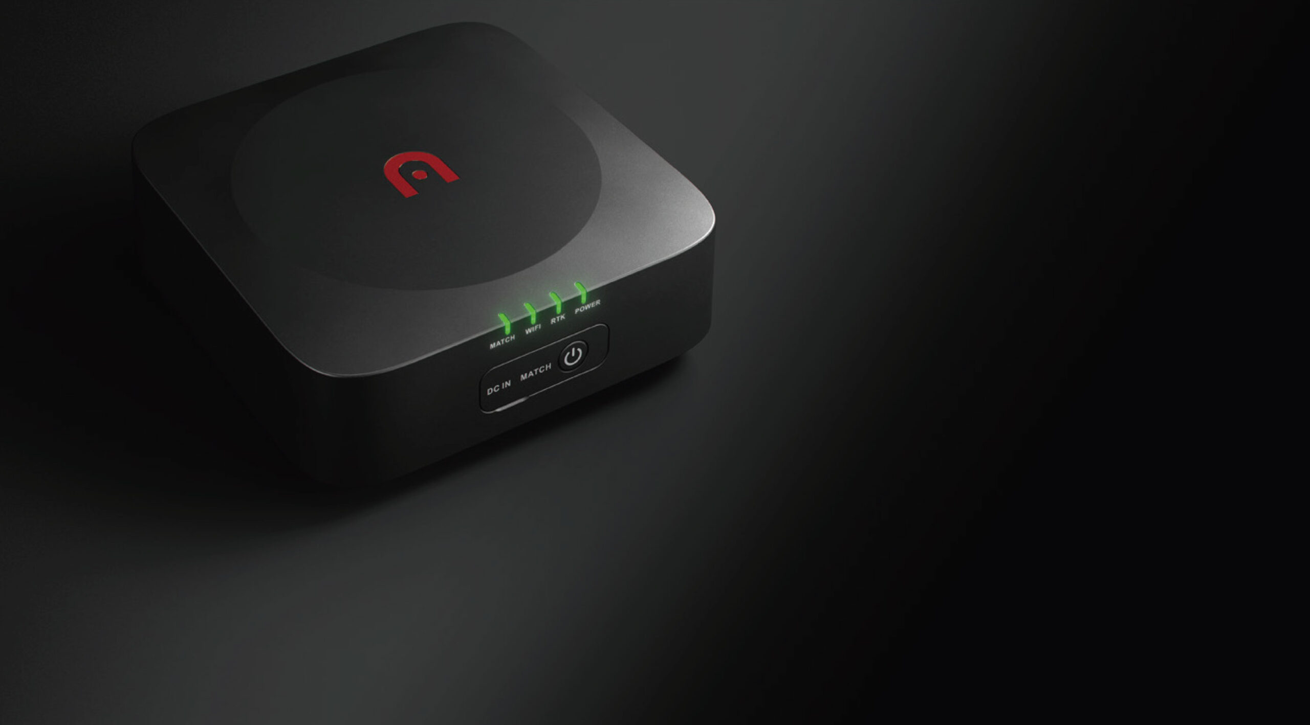
Dragonfish is equipped with two RTK modules with mutual redundancy. The integration of the GNSS base station with the RTK modules gives the Dragonfish quadcopter centimeter positioning accuracy, flawless movement clarity and reliable protection against electromagnetic interference. The mutual redundancy of modules significantly improves the quality of image metadata required for photogrammetry, and also makes flight routes more accurate and safer. The Autel Robotics GNSS base station provides centimeter accuracy and supports all four major satellite navigation systems.
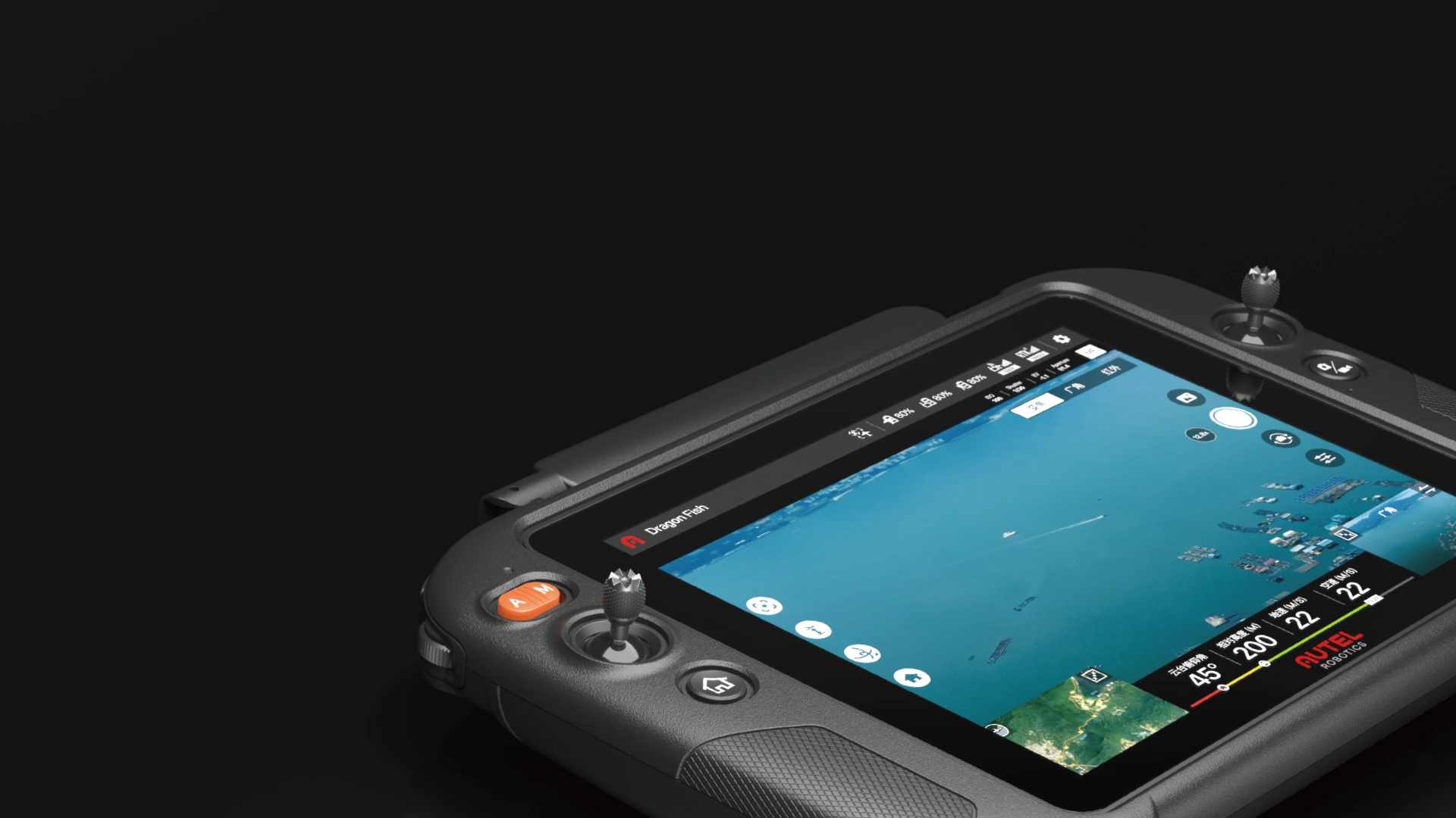
Autel 9.7-inch control station with 1000 nits brightness
One device. Any task.
Autel Voyager Extremely powerful yet easy to use, the Autel Voyager is an all-in-one solution for any task. Specially developed for Dragonfish, the software provides mission planning, intelligent tracking, flight history tracking and other autonomous functions.
• Mission planning: Point missions, polygons and rectangular missions can be planned outside of missions before autonomous flight with one click at the start of the mission. The pilot can regain control at any time during the mission for emergency maneuvers or planning his route trajectory.
• Click to start: Select a target on the camera, and Dragonfish will automatically fly to the selected location and begin flying over the object.
• Mission Management: Monitor past missions and schedule flights.
• Quick Mission: Set points of interest on the flight map during any part of the mission and the Dragonfish will automatically deviate from its original path plan to meet the pilot’s needs.
One device. Any task.
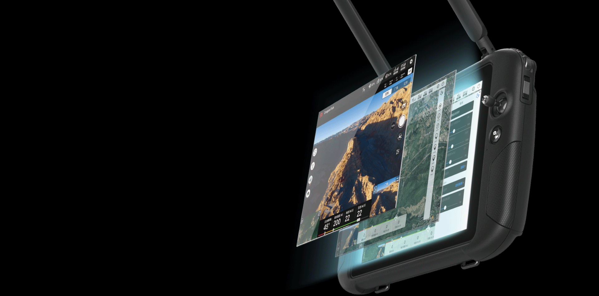
Autel Voyager Extremely powerful yet easy to use, the Autel Voyager is an all-in-one solution for any task. Specially developed for Dragonfish, the software provides mission planning, intelligent tracking, flight history tracking and other autonomous functions.
• Mission planning: Point missions, polygons and rectangular missions can be planned outside of missions before autonomous flight with one click at the start of the mission. The pilot can regain control at any time during the mission for emergency maneuvers or planning his route trajectory.
• Click to start: Select a target on the camera, and Dragonfish will automatically fly to the selected location and begin flying over the object.
• Mission Management: Monitor past missions and schedule flights.
• Quick Mission: Set points of interest on the flight map during any part of the mission and the Dragonfish will automatically deviate from its original path plan to meet the pilot’s needs.

Compact and portable
With an innovative quick-release design and high-speed self-test, the Dragonfish can be airborne and ready for a mission in 5 minutes.

Dragonfish can be easily disassembled by one person, the UAV fits in the trunk of any medium-sized car. The entire system can be assembled without tools in less than 5 minutes.

The entire system self-tests in 5 seconds and is ready to fly in 5 minutes.

The quick-release design of the propellers simplifies assembly and makes it convenient.
Technical characteristics
DRAGONFISH LITE UAV
Dimensions (length*width*height): 965*1600*350 mm
Weight (including battery, without suspension): 4.5 kg
Weight of one battery: 0.75 kg
Maximum load: 1.0 kg
Maximum take-off weight: 5.5 kg
Operating frequency: Image transmission 902-928 MHz (applicable to FCC/ISED standards only); 2.4000-2.4835 GHz; 5.150-5.250 GHz (applicable to FCC/ISED standards only); 5.725-5.850 GHz; digital transmission 5.729-5.771 GHz
Transmit power (EIRP):
900 MHz FCC/ISED: < 30 dBm; 2.4GHz FCC/ISED/RCM: < 30 dBm CE: < 20 dBm; 5.2 GHz FCC/ISED: < 25 dBm 5.8 GHz FCC/ISED/RCM: < 26 dBm CE: < 14 dBm
Pointing accuracy (P-GPS)
Vertically: ±0.1m (when visual positioning is working normally) ±0.5m (when GPS is working normally) ±0. 1 m (when RTK positioning is working normally) Horizontal: ±0.3 m (when visual positioning is working normally) ±1.5 m (when GPS is working normally) (when RTK positioning is working normally) ±0.1 m (when RTK positioning is working normally works fine).
RTK position accuracy
On RTK FIX: Multirotor: 1 cm+1 ppm (horizontal) 1.5 cm + 1 ppm (vertical) Fixed wing: 3 cm+1 ppm ( horizontal) 3 cm + 1 ppm (vertical)
Maximum angular speed of rotation
Inclination axis: 180°/s Rotation axis: 60°/s
Maximum tilt angle: 20°
Maximum roll angle: 35°
Maximum climb speed
Vertical flight mode: 4 m/s
Fixed wing flight mode: 5 m/s
Maximum speed of descent (vertical)
Vertical flight mode: 3 m/s.
Fixed wing flight mode: 5 m/s
Maximum horizontal flight speed: 30 m/s
Flight speed: 0m/s~17m/s (multirotor) 17m/s~30m/s (fixed wing)
Maximum flight height: 4000m
Maximum withstand wind speed:
Fixed-wing flight: 15 m/s (wind level 7) Vertical take-off and landing: 12 m/s (wind level 6)
Maximum flight time: 81 minutes
Adaptation mount
Daotong Huiyan Z2, T3, T3H
Support PTZ installation method: Quick release
IP protection level: IP43
GNSS: GPS+GLONASS+BeiDou+Galileo
Working temperature: from -20°C to 50°C
Transmission frequency 79-81 GHz
Transmission power (EIRP) 25 dBm
Modulation FMCW
Operating cycle 50 ms
Communication interface UART
< strong>Detection distance 0.75-250m
Detection accuracy ±0.1m
Beam width (-6 dB) 30° (azimuth plane) 34° (location plane)
- Energy of one battery – 174 Wh
- The time of one battery charge is 120 minutes
- The ideal storage temperature is from 22°C to 28°
- The ideal charging temperature is from 15 ℃ to 40 ℃
- Working temperature – -20℃ to 40℃
Image Transfer:
- Operating frequency: 902-928 MHz (applicable to FCC/ISED standards only); 2.4000-2.4835 GHz; 5.150-5.250 GHz (applicable to FCC/ISED standards only); 5.725-5.850 GHz;
- Maximum effective signal distance (no interference, no interference): FCC: 10 km CE: 5 km
Digital transmission: Operating frequency: 5.729-5.771 GHz
Wi-Fi:
- Protocol: Wi-Fi Direct, Wi-Fi Display, 802.11a/g/n/ac supports 2 x 2 MIMO Wi-Fi
- Operating frequency: 2.400 – 2.4835 GHz 5.150 – 5.250 GHz (Applicable to FCC/ISED standards only) 5.725 – 5.850 GHz
Battery:
- Lithium-polymer battery Capacity – 8200 mAh.
- Voltage – 11.4 V.
- Battery type – Li-Po
- Energy-93 Wh
- Charging time – 120 minutes
Battery life: Approximately 3 hours (maximum brightness) Approximately 4.5 hours (50% brightness)
Storage: 256GB ROM + expandable (supports TF card)
Video output interface: HDMI interface
Power supply voltage/current of USB-A interface: 5V/500mA
Working temperature: -20℃ to 40℃
Ambient temperature for charging: from 0 ℃ to 45
Ambient temperature for storage:
- -20 ℃ to 60 ℃ (within one month)
- -20 ℃ to 45 ℃ (within three months)
- -20 ℃ to 30 ℃ (within one year)
Satellite positioning module: GPS+GLONASS+Galileo
Size: < /p>
- 319×233×74 mm (antenna folded)
- 319×398×74 mm (antenna unfolded)
Weight: 1987
Receiver
- Frequency points of satellite reception (simultaneous reception): GPS: L1, L2, L5 BeiDou: B1, B2, B3 GLONASS: F1, F2 Galileo: E1, E5A, E5B
- Positioning Accuracy: Single Point Horizontal: 1.5m (RMS) Vertical: 3.0m (RMS) RTK Horizontal: 1cm+1ppm (RMS) Vertical: 1.5cm+1ppm (RMS) 1 ppm: accuracy degrades with each additional 1 km 1 mm. For example, if the distance from the base station is 1 km, then the accuracy is 1.1 cm.
- Positioning update frequency: 1 Hz, 2 Hz, 5 Hz, 10 Hz and 20 Hz
- Cold start: < 40 s
- Warm start: < 10 s
- Recapture: < 1 s
- Initial reliability: >99.9%
- Differential data transfer format: RTCM 2.X/3.X
- Data transmission channel: image transmission channel, Wi-Fi
Image transfer
- Operating frequency: 902-928 MHz (applicable to FCC/ISED standards only);
2.4000-2.4835 GHz;
5.150-5.250 GHz (applicable to FCC/ISED standards only);
5.725-5.850 GHz; - Equivalent Isotropic Radiated Power (EIRP): 900 MHz
FCC/ISED: < 30 dBm; 2.4 GHz
FCC/ISED/RCM: < 30 dBm
CE: < 20 dBm; 5.2
GHz FCC/ISED: < 25 dBm 5.8
GHz FCC/ISED /RCM : < 26 dBm CE: < 14 dBm
Wi-Fi
- Operating frequency: 5.725-5.850 GHz
- Equivalent isotropic radiated power (EIRP) 5.725-5.850 GHz
- FCC/ISED/RCM: < 26 dBm; CE: < 14 dBm
- Communication distance:
base station and aircraft: 30 km (FCC)
Base station and ground station: 200 m (FCC) (unobstructed, unobstructed;
base station installation height is 2 m from the antenna to the end of the tripod, and the difference in height with the ground station within 10 m, the height of the ground station from the ground is 1.2 m)
Electrical characteristics
- Power consumption: 7.5 W
- Power supply: 5 to 20 VDC
- Battery:
Type: Lithium-polymer battery
Capacity : 4950 mAh
Energy: 57.1 Wh
Working time: > 7.5 hours
Physical properties:
- Dimensions (base station main body + extension): 193 mm × 177 mm × 73 mm
- Weight: 1275 g
- Dustproof and waterproof: IP64
- Working environment temperature: from -20 ℃ to 50 ℃
- Airplane – 1 pc.
- Ground station with a 9.7-inch screen – 1 pc.
- Base station – 1 pc.
- Battery – 4 pcs. (the number of relevant items depends on the set purchased).
- Charger + power cable – 1 pc.
- Propeller blades – 2 pcs.
- Base station antenna – 2 pcs.
- Base station power cable – 2 pcs.
- Basket for base station – 1 pc.
- Tripod for base station – 1 pc.
- Charger for the base station – 1 pc.
- USB Type-C cable – 1 pc.
- Set of tools for repair – 1 pc.
- Camera – 1 pc. (the gimbal model depends on the specific kit purchased)
- Set of wings – 1 pc.
- Tail – 1 pc.
- Tail cover – 1 pc.
- Air speed indicator cover – 1 pc.
- Ground station strap – 1 pc.
- Propeller holder – 2 pcs.
- TF card – 1 pc.
- Documentation – 1 set

