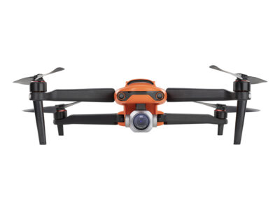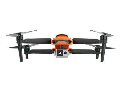


Quadcopter Autel Evo Max 4T
Autel Evo Max 4T is a modern, powerful quadcopter designed for long flights and high-quality aerial photography.
Advanced sensors allow you to fly in areas inaccessible to GPS, and the powerful characteristics of the camera and thermal imager open up new scenarios for identifying and tracking objects.
– 20 km range of data transmission
– 42 min flight duration
– 8K with 10x optical zoom
– Thermal camera: 640×512 with 16x digital zoom
– Wide-angle camera: 50 MP | 1/1.28″ CMOS
– Camera with zoom: 48 MP
– Laser range finder
– Network technology A-Mesh 1.0
– 720° obstacle avoidance
9199,00 €
Available on backorder
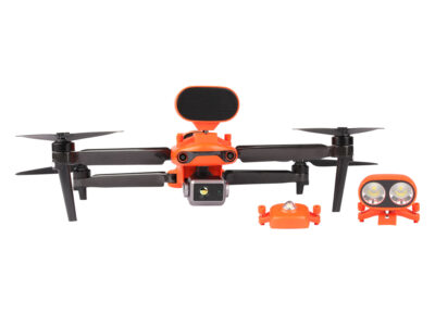
Complete set
1 x Autel EVO Max 4T quadcopter (battery, propellers, camera, camera case, 64GB SD card);
1 x Smart Controller V3 (joysticks included);
3 x pairs of propellers;
1 x battery charger + power cable;
1 x controller strap;
1 x controller cover;
1 x pair of spare joysticks for the controller;
1 x controller charger;
1 x charging cable for the controller;
1 x data cable;
1 x screwdriver;
1 x case.
Explore new horizons
EVO Max 4T is a powerful and highly functional drone designed for the most demanding tasks. It is equipped with a 4K Ultra HD camera, has sufficient endurance – up to 42 minutes of flight, and protection according to the IP43 standard against weather conditions, allowing to work in various atmospheric conditions. The ability to fly up to 4,000 meters and transmit images up to 20 kilometers makes it an ideal choice for aerial surveillance.
42min
Max flight time
IP43
Weather protection class
43km/h
Maximum wind resistance
7000 m
Practical ceiling
20 km
FCC data transmission range

Leader among intelligent drones
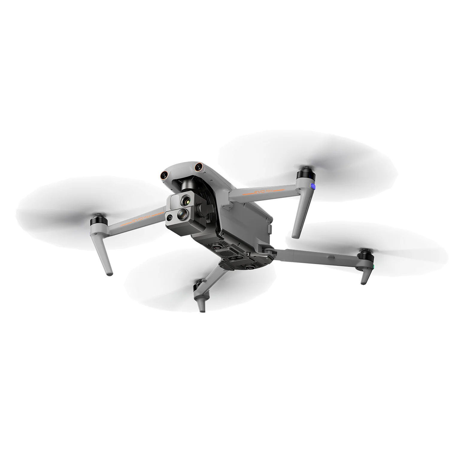
EVO Max 4T offers users powerful technologies and extended autonomy. The EVO Max 4T evaluates complex environments to generate real-time 3D flight paths for unparalleled obstacle avoidance. Advanced sensors make it possible to fly in areas with no GPS, and an incredible new thermal imaging camera on board opens up new scenarios for object identification and tracking. Thanks to its foldable, weatherproof design, the EVO Max 4T is not only portable, but also very efficient.


Payload ready for mission
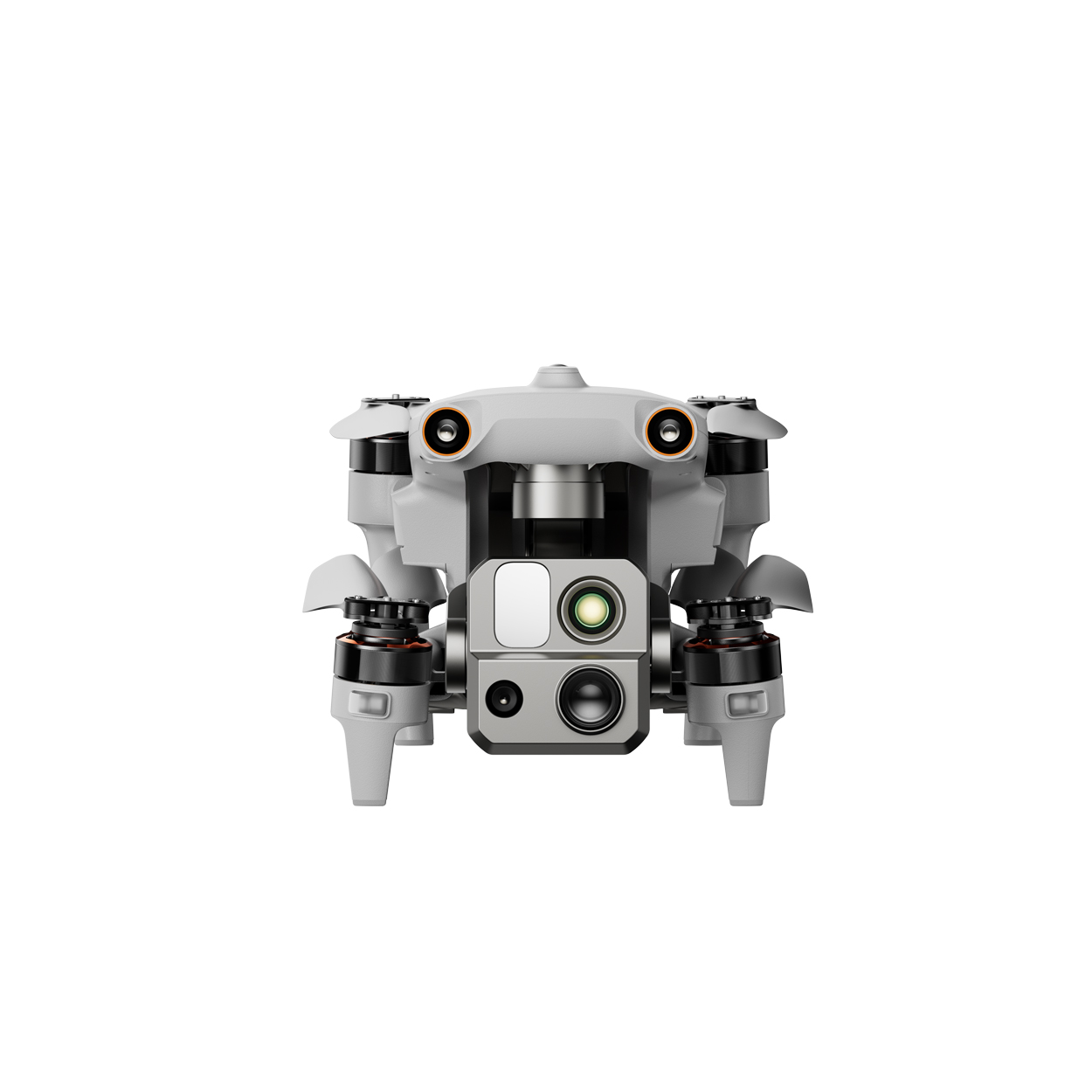
The payload includes a Starlight camera, a wide-angle camera, a zoom camera, a thermal imaging camera, and a laser rangefinder for all your data collection and decision-making needs.
50 MP
Wide-angle camera
48MP
Camera with zoom
8k 10s
Optical zoom
160s
Maximum hybrid scaling
640×512
Thermal resolution


Follow the object and determine the exact distance
")
Zoom in and view the object in detail
 (1)")
The thermal imaging camera allows you to perform missions even at night

Get clear images in low light
No blind spots. Complete obstacle avoidance.
The EVO Max series combines traditional binocular vision systems with millimeter wave radar technology. This allows Autel’s built-in autonomy mechanism to perceive objects as small as 0.5 inches, eliminating blind spots and ensuring operation in low light or rain conditions.
")
Resistance to electromagnetic and radio interference.
The EVO Max series uses advanced flight control modules and algorithms specifically designed to counter RFI, EMI and GPS spoofing. This allows EVO Max series quadcopters to confidently fly near power lines, critical structures and in difficult areas.

A-Mesh 1.0 is the first mesh network technology in the UAV industry
EVO Max 4T is equipped with the new A-Mesh system, which provides autonomous communication, connectivity and cooperation between drones.

Reliable resistance to obstacles
EVO Max 4T can easily communicate with other nearby drones, unlike the traditional chain structure. If one drone goes down or goes offline, the entire system will reorganize itself and continue to transmit critical information.
Complete control over LA Park
Several drones can be controlled autonomously by one pilot or simultaneously by a group of pilots regardless of LTE coverage.
Out of line of sight applications
Thanks to A-Mesh, several aircraft located in close proximity to each other can act as relay points, greatly increasing the effectiveness of operations beyond line of sight.
Extended range
Communication nodes can be placed statically on hills or poles to provide full area coverage, or a swarm of drones can provide mobile communication points to extend the coverage of the entire group.
Autel Enterprise App Platform
Autel Enterprise application is specially designed for controlling the quadcopter, it has a clear interface for simple and efficient operation. Additional functions and semi-autonomous modes allow you to use the capabilities of the EVO Max 4T as efficiently as possible.
Data Security
User and aircraft information, including flight logs, location and account information, may only be accessed physically and locally through the aircraft. Supports AES-256 encryption for photos, videos and flight logs and has password protection.

Protection Level: IP43
IP Rating
From -4 ℉ to 122 ℉
Working temperature
Ecosystem
The payload includes a Starlight camera, a wide-angle camera, a zoom camera, a thermal imaging camera, and a laser rangefinder for all your data collection and decision-making needs.

Autel Smart Controller V3
Daylight-visible display: 7.9 inches, maximum brightness 2000 nits, resolution 2048*1536.
Download videos from drones to mobile devices with a maximum speed of 20 MB/s.
Functional interface: HDMI ports allow you to connect to third-party displays or monitors.
Extreme battery life: up to 4.5 hours of continuous operation. 2-hour fast charging from 0.
Storage: 128GB of built-in storage allows you to use third-party apps and save multimedia data for tasks.

EVO Nest (optional)
EVO Nest is a base for automatic takeoff, landing, charging and mission planning for the EVO series.
Nest is designed for all-weather operation and uses a one-piece protective drum with fewer moving parts for easier maintenance.

RTK module (optional)
Provides centimeter-accurate location data for mapping and reduces electromagnetic interference when flying near critical structures.
Technical characteristics
QUADROCOPTER AUTEL EVO MAX 4T
Size:
562 x 651 x 147 mm (in unfolded form, with propellers);
318 x 400 x 147 mm (expanded, without propellers);
257 x 145 x 131 mm (folded, without propellers);
Weight: 1.6 kg
Max. take-off weight: 2 kg
Max. flight time:
42 min (without wind);
38 min (hanging without wind);
Max. flight height: 4000 m
Max. speed: 23 m/s
Max. climb rate: 8 m/s
Max. descent speed: 6 m/s
Battery capacity:
4S 8070 mAh lithium-polymer battery;
Built-in memory:
128 GB of built-in memory;
64 GB of free space;
(the remaining available space depends on the firmware version);
Degree of protection: IP43;
Range of working temperatures: from -20°C to 50°.
Operating frequencies: 900MHz/2.4GHz/5.2GHz/5.8GHz;
GNSS:
GPS+Galileo+BeiDou+GLONASS
Stabilization:
3 axes (tilt, roll and turn);
Camera with zoom
- Sensor: 1/2″ CMOS, 48 MP;
- lens: focal length: 11.8 to 43.3mm (35mm equivalent: 64 to 234mm);
- aperture: from f/2.8 to f/4.8;
- ISO range:
from 100 to 12,800 (photo);
from 100 to 6400 (video); - shutter speed:
from 8s to 1/8000s (photo);
from 1s to 1/8000s (video); - maximum photo resolution: 8000×6000;
- maximum video resolution: 7680×4320;
Wide-angle camera
- sensor: 1/1.28 CMOS, 50MP;
lens: angle of view: 85°; focal length: 4.5 mm (equivalent: 23 mm); aperture: f/1.9; - ISO range:
Auto: from 100 to 6400 (photo); from 100 to 64,000 (video)
Manual: from ISO100 to 12800 (photo); from ISO100 to 6400 (video); - shutter speed:
from 8s to 1/8000s (photo);
from 1s to 1/8000s (video); - maximum photo resolution: 4096×3072;
- maximum video resolution: 3840×2160;
Thermal imaging camera
- Thermal imager: non-cooled VOx microbolometer
- Lens: viewing angle: 42°; focal length: 13 mm; aperture: f/1.2;
- Infrared temperature measurement accuracy: ±3°C or reading ±3%
- Temperature measurement range: –20°C to 150°C, from 0 to 550°C;
- Maximum photo resolution: 640 512;
- Maximum resolution video: 640×512 25k/s;
- Temperature alarm: Thresholds for triggering the alarm signal at high and low temperature, reporting coordinates and values temperature
Laser range finder
- Measurement accuracy: ± (1 m + D×0.15%) D is the distance to the vertical surface;
- Measurement range: from 5 m to 1.2 km;
Visual recognition system
Obstacle detection range: Forward/up/down/back/side: 0.2–50 m
Viewing angle: Forward/backward/sideways: 60° (H), 80° (V) Up/down: 360° (H), 190° (V)
Recognition system based on millimeter range radar
Frequency: 60 GHz–64 GHz*
Dimensions: 1.5*0.55*0.08 inches (L*W*H)
Weight: 0.07oz (2g)
EIRP: 18 dBm
Recognition range: Top: 5.9-787.4 inches (0.15–20 m) Down: 3.9–4724.4 in. (0.1–120 m) Fore and Aft (Standard/Comfortable): 0.82–98.43 ft. (0.25–30 m )
Viewing angle: Back and forth (Ludicrous) : 1.64–196.85 ft (0.5–60 m)
Velocity measurement range: Horizontal (6 dB) : ±60°, Vertical (6 dB): ±30°
Speed accuracy: ±134 mph (60 m/s) ≤1 %
Maximum number of recognized targets: 32< /span>
Hovering without GPS and manual flight control:
Indoors:
Horizontal error ≤ 1.18 inches (relief in at least one direction)
Outside the premises:
Daytime: Within a flight altitude of 1,640 feet (500 m) the horizontal error < 0.01*altitude Night: Manual flight control is possible within a flight altitude of 328 feet (100 m).
Automatic route change to avoid obstacles:
Within a flight altitude of 1640 ft (500 m), the horizontal error of the homing point < 11.81 inches
Automatic route change to avoid obstacles:
High-speed rerouting to avoid obstacles: Flight speed up to 45 mph (20 m/s) with a minimum safe obstacle distance of 4.9 ft (1.5 m)
High-precision rerouting to avoid obstacles: Flight speed can reach 6.7 mph (3 m/s) with a minimum safe obstacle distance of 1.64 ft (0.5 m)
Multiple target recognition and tracking:
Types of target identification: people, vehicles, boats Number of detected targets: 64
High recognition accuracy: > 85%
1 x Smart Controller V3 (joysticks included);
3 x pairs of propellers;
1 x battery charger + power cable;
1 x controller strap;
1 x controller cover;
1 x pair of spare joysticks for the controller;
1 x controller charger;
1 x charging cable for the controller;
1 x data cable;
1 x screwdriver;
1 x case.